 |
| Mundabbera water tower |
Our return south was very brief; long enough to get a few things done and catch up with family and friends before we froze over! After six days on the road and ten days in Melbourne, we locked up our house on a cold and grey Wednesday, walked to the station and caught the train and the bus and then we boarded a plane bound for the Gold Coast. We arrived to sunny skies and a light breeze! We collected Vanooka from the storage facility and drove via Dan Murphy's and the Runaway Bay shopping centre and packed our adventuring clothes. Early next morning, with the van packed and ready to roll, we headed out along the motorway. We spent the night with Ian and Jo-Anne, enjoying time also with mum Elizabeth and cousin Vicky, and sleeping just outside their holiday apartment at Noosaville, then turned the car northwest, stopping in Gympie for some last-minute supplies at the Aldi supermarket, conveniently located on the road into town and with plenty of parking for our car and van. Satisfied with our purchases, we continued west, stopping at Kilkivan for morning tea and Gayndah for bakery goods, then onto Mundubbera, our home for tonight. We are in farming country here, and there are many itinerant farm workers stationed here from April to September, picking citrus fruits, blueberries and lots of other produce for markets all over Australia. We walked into town and checked out the shops before returning to Vanooka for a delicious dinner and a well-earned sleep.
 |
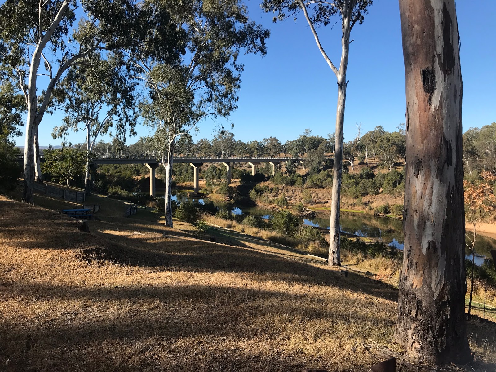
| Way down to the Burnett River |
Next morning, we walked along the banks of the Burnett River, marvelling at how high the river rises during floods. We continued through town and back to the van for breakfast, then we packed up and hit the road. We turned off the Burnett Highway just after Eidsvold, where the R.M.Williams centre is visited by many Akubra wearing folk, and headed along the backroads through Cracow and Theodore, big mining complexes dotted along the road between these sleepy towns. We briefly joined the Leichardt Highway but quickly turned west for our next destination, Moura, located on the Dawson Highway. We are in the southern reaches of the Bowen Basin, a rich vein of coal exploited by large mining companies, with coal seam gas extracted by energy companies, as well as large beef stations along the way. Once again the caravan park is filled with dongas, these ones used by the fly-in, fly-out miners. There is also a large memorial dedicated to mine workers who have lost their lives in accidents in the local area. It is very sobering to visit and read the stories of these disasters.
 |
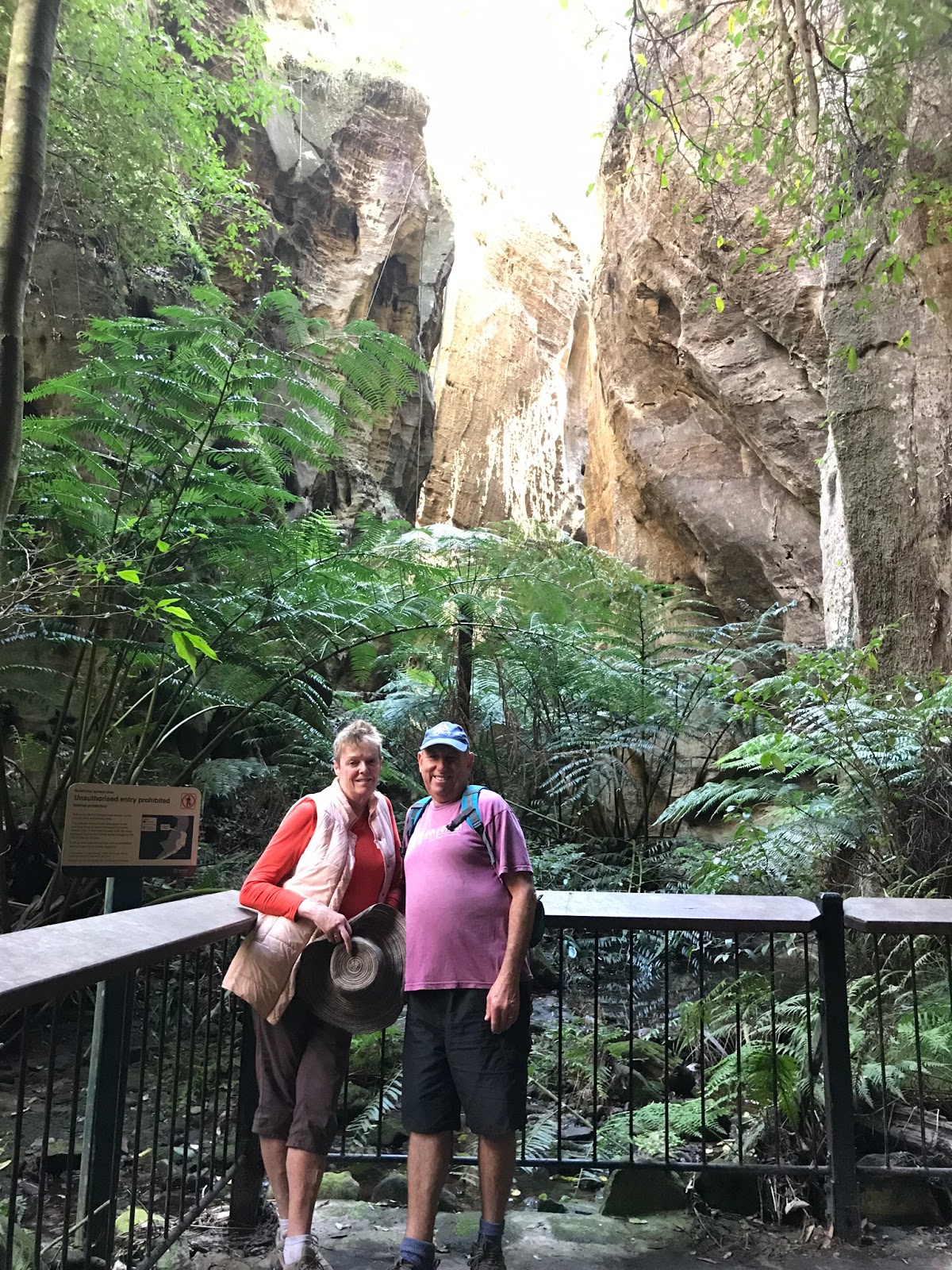
| Mickey's Creek Gorge |
On Sunday morning we were up early again, in order to give ourselves plenty of time at our next destination: Carnarvon Gorge! We arrived just in time for lunch, then drove to the visitors' centre to make plans for the next few days. Later we took a "short" walk to Mickey's Creek gorge and marvelled at the forces of water that created the cliffs, gullies and gorges here. That evening we attended "Happy hour" at Takarakka Bush Camp, where we are staying, to hear the information about the range of walks and climbs we could do. Just on sunset, we walked to the creek to see a platypus swimming around, ducking and dodging in the water catching insects for its dinner. We returned to Vanooka for pizzas and an early night - we are planning a big day of walking tomorrow!
 |
| Rock-hopping |
 |
| Boowinda Gorge |
 |
| Aboriginal stencil art |
 |
| Ward's Canyon |
 |
| Moss Garden |
On Monday we were up at sunrise, with breakfast eaten and lunch prepared, and parked at the Visitors' Centre by 8am. We crossed the first of many creek crossings and trekked along the path, winding along beside the creek, and crossing it more than 20 times in our quest to see as many sites as we could manage in a day. We hiked to the other end of the path, at Big Bend, almost 10 kilometres away, where we enjoyed water and some morning tea to revive us, before heading downstream again. First stop was Boowinda Gorge, a narrow, winding crack through the rocks, with mossy sandstone sides and moist ferns, where we picked our way amongst the river rocks trying not to turn an ankle! Next were two aboriginal art sites: Cathedral Rock and The Art Gallery, with many ochre stencils and rock carvings to admire. As we trekked further east there were more challenging sites to visit: Wards Canyon - a short, steep, winding track to a cool, fern-filled garden beside a waterfall, The Amphitheatre - up a rocky path and a ladder into a huge chamber with high sandstone walls, then Moss Garden - another climb, this time into a cave filled with mosses and ferns. It was an awe-inspiring day, well worth the tired legs and feet! We returned to camp just after 4pm, enjoying a foot soak and an early dinner before falling into bed.
 |
| Inside the Amphitheatre |
 |
| Going up! |
We had more to see at Carnarvon Gorge on Tuesday! We left just a little later, arriving at the gorge at 8:45 for a shorter, steeper walk: up the side of the gorge and onto Boolimba Bluff! The walk itself was just over 6km, but it included a 300m climb from the gorge floor to the bluff; with steep, rocky steps and three ladder sections it was a challenge, but the spectacular views were certainly worth it!
 |
| Spectacular views |
Returning to the car for morning tea, we drove to The Rockpool on our way back, but the temperature of the water did not tempt us for a swim! We returned to camp for lunch and a lazy afternoon, but we finished off the day with a walk to the lookout to view the sunset. We have really made the most of our three days at Carnarvon Gorge, but it is time to continue our journey west.
 |
| Sunset at Takarakka bush camp |
 |
| Van Gogh's "Sunflowers" |
On Wednesday morning we were up bright and early, packed and ready to continue our travels just after 8am. Driving back along the park entry road, we passed many cattle enjoying the green pastures, some ambling across the road as we slowly approached. Rejoining the highway, we bypassed Rolleston, stopping in Springsure for fuel and continuing along the Dawson Highway. We passed more large coal mines as we travelled along on our way to Emerald, the largest town in the Central Highlands district, strategically located on the intersection of the Capricorn Way, which runs between Rockhampton and Longreach, and the Great Inland Way, between Roma and Charters Towers. Emerald is known for coal, cattle and red-claw crayfish, caught in Lake Maraboon, 15km away. We pulled into the Emerald Tourist Park just after 11am, unhitched, unpacked and headed into town. Visiting the Information Centre, we learned about the local attractions, including the largest Van Gogh painting, a mural walk, pioneer village and the Botanical Gardens. Plenty to keep us busy for two days! We walked along the main street and saw a range of art installations along the way and in the local gallery. Like many towns, Emerald's main street has lost a lot of its shops as they have moved to shopping malls on the outskirts, there have also been several pub fires that have destroyed local icons, however the Railway Station retains its historic appeal.
 |
| Botanical gardens |
 |
| Lake Maraboon |
Thursday was a "rest" day. We started with our exercises before breakfast, then drove to the Botanical Gardens for a walk around. They have been beautifully planted with many different environmental areas and waterways. Later we drove out to Lake Maraboon, also known as Fairbairn Dam at the spillway. There is a lot of renovation works being undertaken on the spillway and downstream, taking advantage of low lake levels in the drought. We had hoped to try the famous Red Claw Crayfish but unfortunately the cafe was closed in the quiet conditions. We returned to our camp for lunch and a lazy afternoon. Tomorrow we continue west, leaving the Central Highlands for the Outback!
 |
| Outback here we come!! |


No comments:
Post a Comment