 |
| Round Island - low tide |
 |
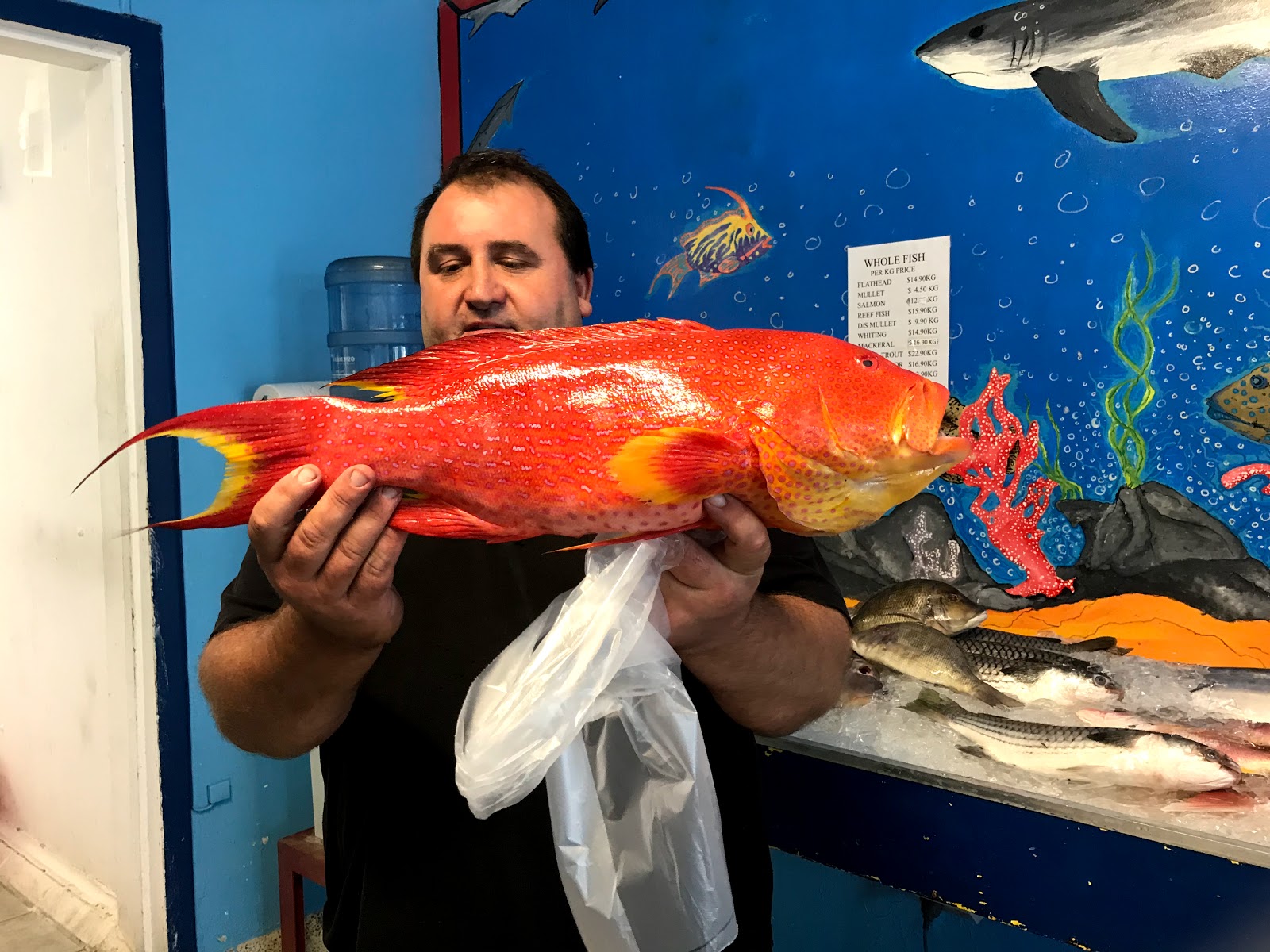
| Freshly caught Coral Trout |
After ten days on anchor, the wind was forecast to change
direction and life at Platypus Bay would no longer have been so pleasant. We
cruised west, rounding Moon Point and heading over to Big Woody Island, hoping
to walk up to the historical lighthouse, built in 1866 to show the way through
the straits and guide cargo ships to the entrance to the Mary River, on their
way to Maryborough. After dropping anchor and making our way through the rocky
shallows in the dinghy, we approached the track only to discover it closed,
part of the Covid-19 lockdown. Chastened, we returned to Manookatoo and
continued west, dropping anchor just off Round Island, near the entrance to
Urangan boat harbour. As the tide dropped, we went ashore and walked around the
sandy shore, staying away from the trees in the centre where hundreds of birds
were roosting very noisily. The next morning we raised the anchor and headed over
to the Marina in order to restock with supplies and water. We spent a whole day
visiting supermarkets and other supply stores and fitting everything into the
boat, including fillets of Coral Trout caught that morning and filleted while we waited; you can't get much fresher than that! The next morning we went riding, taking the coastal path up to Torquay,
returning to Manookatoo for a lazy afternoon.
 |
| Farewell Hervey Bay |
As restrictions began to be eased, in Queensland
at least, people were allowed to travel a little further and recreational
boating was allowed again. We decided it was time to make tracks! Leaving the marina at 5:30am, we cruised along the coastline of Hervey Bay through slightly rolling waves, entering the Burnett River just after midday and cruising up to the Port Bundaberg Marina. We filled the boat with fuel, taking advantage of the low price of diesel and the subsequent reduction in berthing fees - the best deal we have seen so far! After lunch we took a walk into the small village of Burnett Heads, following the riverfront path past fishermen and the old marina, which was heavily silted up following the 2013 floods.
| The view from the top of Bustard Head |
 |
 |
Bustard Head lighthouse
|
We returned to the boat for an early night as we had a longer cruise planned for the following day, taking us further north, past 1770 and Bustard Head lighthouse and into Pancake Creek. This is a great safe anchorage, very popular with boaties heading north and south and, as the wind was predicted to be strong for the next few days, we were happy to pull up a mooring for a longer stay. Either side of the deep channel, the sand dries at low tide, and walking either on the large island in the middle or along the beach is very pleasant. The next day we ventured up the hill to the old Bustard Head lighthouse, the first one built by the state of Queensland in 1868. At the moment the lighthouse is closed for tours, but we enjoyed the walk through the Chinaman Creek wetlands and along the bushy path with views across Aeroplane Beach and the ocean as we went. More boats arrived as the day progressed; other boaties also looking for safe anchorage. We enjoyed the next few days at Pancake Creek, doing not much more than a bit of walking each day and a few odd jobs.
 |
| Stay out of my way! |
 |
Crossing the cattle grid
|
By Friday the winds had eased a little and we were ready to continue our journey north, however there was still enough of a swell to put us off our original idea of following the east side of Curtis Island, so instead we opted to cruise in through the main shipping channel towards Gladstone. After tying up at the public jetty, getting rid of some garbage and buying a few supplies, we continued past all the industrial ports and into the quieter parts of the waterway, cruising slowly as we were against the tide, running fast at this time as the moon is full. As the middle part of this waterway, known as "The Narrows", dries at low tide, we anchored on the southern edge, at Black Swan Island, for the night. Surrounded by mangroves, there were quite a few midgies arond mosquitoes around at dusk, but we covered up well, sprayed the Aeroguard, and enjoyed sundowners on the flybridge. We had a later start the next morning as high tide wasn't until after 9am and we cruised up slowly between the mangroves, following the channel markers and leads, as well as the boat's own navigation, passing over the cattle run and road from the mainland to Curtis Island, and out into deeper water, breathing a sigh of relief when we were through!

 We continued north, into Keppel Bay, encountering a rolly swell across the ocean, arriving at Great Keppel Island just before 3pm. We have now reached the Tropic of Capricorn, well before winter, and look forward to enjoying some warm weather!
Captain's Log:
Distance travelled:189 nautical miles
Travel time: 29 hours 55 minutes
Fuel consumption: 197.3 litres

Really enjoy reading about your trip, keep having fun........ Geoff
ReplyDeleteWhat a great blog! Looking forward to the updates along your journey north!
ReplyDeleteCheers,
Sue